


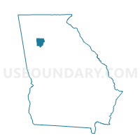
067BT02 - BRYANT 02 Voting District, Cobb County, Georgia
About
Outline

Summary
| Unique Area Identifier | 560897 |
| Name | 067BT02 - BRYANT 02 Voting District |
| County | Cobb County |
| State | Georgia |
| Area (square miles) | 5.63 |
| Land Area (square miles) | 5.55 |
| Water Area (square miles) | 0.08 |
| % of Land Area | 98.52 |
| % of Water Area | 1.48 |
| Latitude of the Internal Point | 33.76588960 |
| Longtitude of the Internal Point | -84.57427020 |
Maps


Graphs
Select a template below for downloading or customizing gragh for 067BT02 - BRYANT 02 Voting District, Cobb County, Georgia


Neighbors
Neighoring Voting District (by Name) Neighboring Voting District on the Map
- 067BT01 - BRYANT 01 Voting District, Cobb County, GA
- 067PE01 - PEBBLEBROOK 01 Voting District, Cobb County, GA
- 067RS01 - RIVERSIDE 01 Voting District, Cobb County, GA
- 0971270 - COLONIAL HILLS Voting District, Douglas County, GA
- 0971275 - LITHIA HIGH SCHOOL Voting District, Douglas County, GA
- 121SC14 - SC14 Voting District, Fulton County, GA
- 121SC16A - SC16A Voting District, Fulton County, GA
Top 10 Neighboring County Subdivision (by Population) Neighboring County Subdivision on the Map
- Atlanta CCD, Fulton County, GA (531,648)
- Douglasville-Lithia Springs CCD, Douglas County, GA (70,215)
- Mableton CCD, Cobb County, GA (55,614)
Top 10 Neighboring Place (by Population) Neighboring Place on the Map
Top 10 Neighboring Unified School District (by Population) Neighboring Unified School District on the Map
- Cobb County School District, GA (631,499)
- Fulton County School District, GA (528,870)
- Douglas County School District, GA (132,403)
Top 10 Neighboring State Legislative District Lower Chamber (by Population) Neighboring State Legislative District Lower Chamber on the Map
Top 10 Neighboring State Legislative District Upper Chamber (by Population) Neighboring State Legislative District Upper Chamber on the Map
- State Senate District 35, GA (214,483)
- State Senate District 6, GA (166,643)
- State Senate District 38, GA (145,163)
Top 10 Neighboring 111th Congressional District (by Population) Neighboring 111th Congressional District on the Map
Top 10 Neighboring Census Tract (by Population) Neighboring Census Tract on the Map
- Census Tract 313.11, Cobb County, GA (9,151)
- Census Tract 103.03, Fulton County, GA (8,727)
- Census Tract 313.09, Cobb County, GA (7,392)
- Census Tract 801.02, Douglas County, GA (6,952)
- Census Tract 801.03, Douglas County, GA (6,371)
- Census Tract 313.10, Cobb County, GA (6,301)
- Census Tract 313.08, Cobb County, GA (4,776)
- Census Tract 78.05, Fulton County, GA (3,449)